-
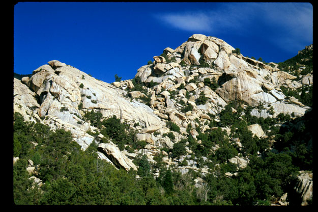
 Colorado National Monument
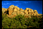
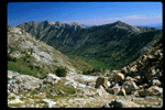
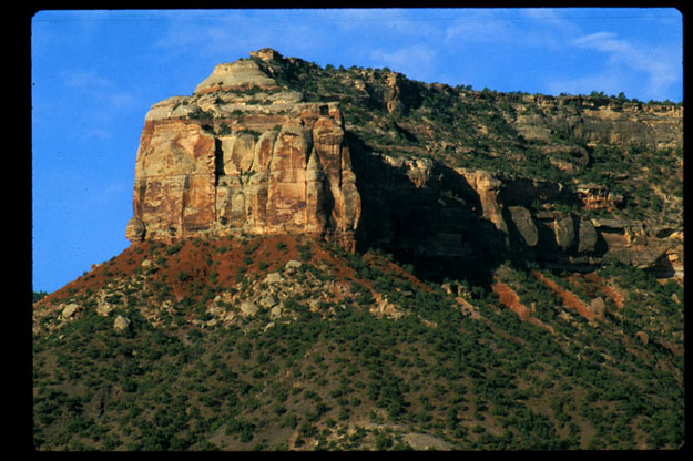
- This is a cliff wall on the border of
Colorado National Monument
viewed from outside the park. It is typical of the surroundings.
-
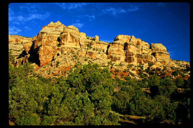
 Golden Light
- This is another photo of Colorado National Monument from within the park.
At this early hour, the rockfaces were very colorful.
-
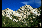
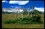
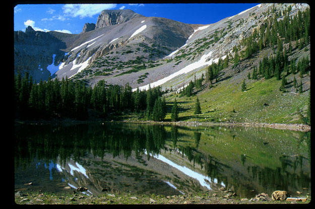
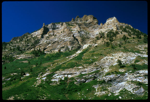
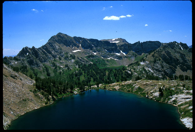
 Wheeler Peak
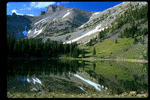
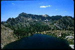
- This was taken at Great Basin National Park. in Nevada.
The high point in the
background is Wheeler Peak which is the highest point in the Snake Range.
There is very little surface water in the mountains and this small lake was
certainly a rarity.
-
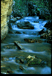
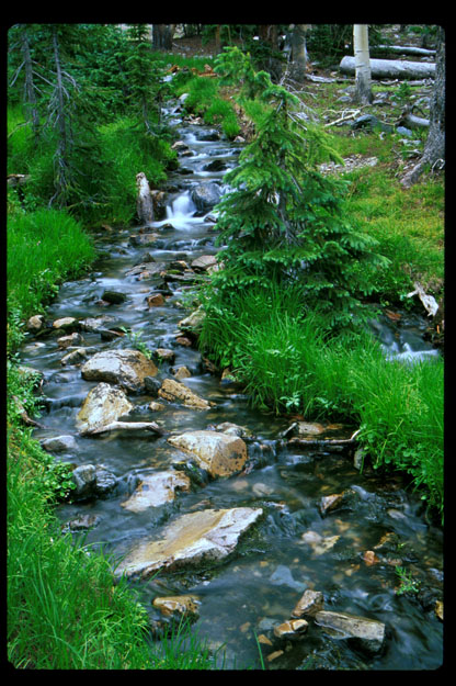
 Great Basin Stream
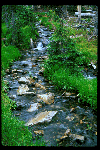
- This is the typical size of a stream in Great Basin National Park. I
only saw one other stream and it vanished into a hillside after I followed
it for a few hundred meters.
-
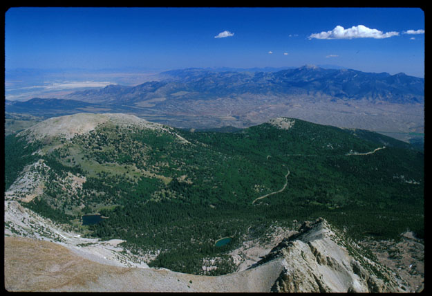
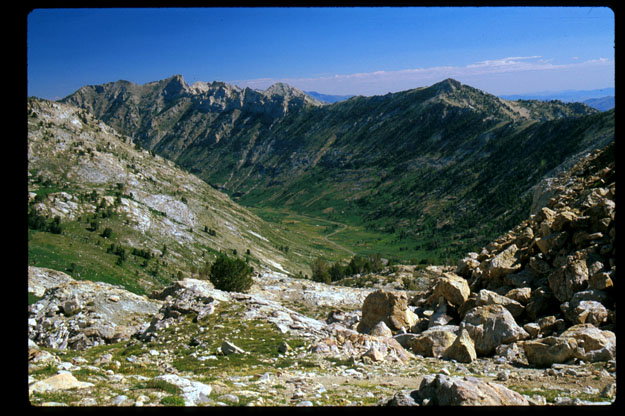
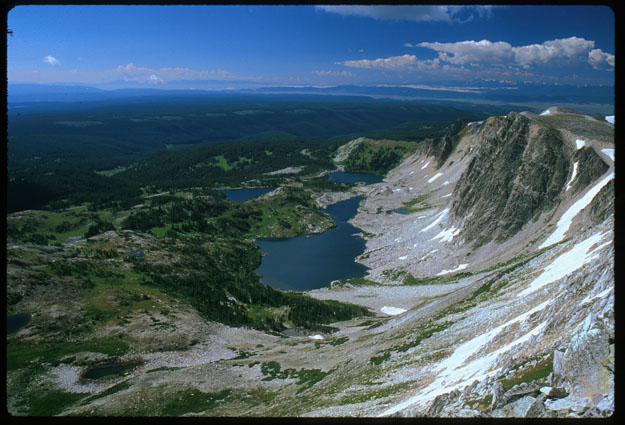
 The Great Basin
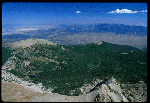
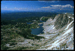
- The is the view from the top of Wheeler Peak (13063ft=3982m).
It looks approximately north into
the rest of the Snake Range in Nevada and perhaps into parts of Utah. Two lakes
are visible in the image (a greenish one on the lower left and an aquamarine
one in the lower center). The one on the left is the one in the earlier photo.
The hike to the top is 8 miles round trip. It is very easy at the beginning
but the last mile is pretty steep. I reached the top at about 8 am which
helped me avoid any hot Sun on the way up.
-
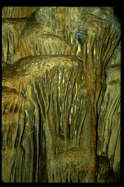
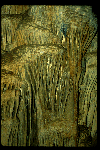 Lehman Caves
- This is also at Great Basin National Park. It is inside Lehman Caves
which is where most of the tourists go when they visit the park. It is just
a typical photo of the cave's formations.
-
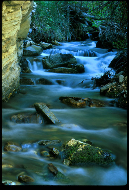
 Another Snake Range Stream
- This is a photo of Deadman's Creek in the Snake Range north of Great
Basin
National Park. Although the national park gets many visitors, the section of
the Snake Range outside the park (and on the other side of US 50) is rarely
visited. This creek is a side canyon in much larger Smith Creek Canyon.
-
 The Deep Creeks
- This picture was taken in the Deep Creek mountains of northwest
Utah. They are
slightly north of the Snake Range and very isolated. The high point (Mount
Ibapah) reaches about 8000 feet above the surrounding desert. I explored
the beginnings of Indian Farm Creek Canyon. It doesn't really have a trail but
it is quite pretty. The rocks here are very white and that is shown in the
photo above. There was a lot of good rock scrambling in the area.
-
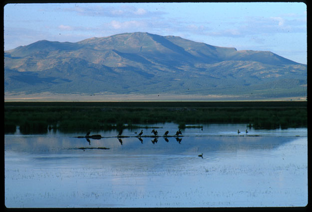
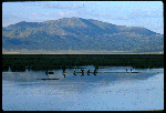 Ruby Marsh National Wildlife Refuge
- This was taken soon after sunrise at
Ruby Marsh National Wildlife Refuge
in Nevada. This marsh lies on the eastern side of the
Ruby Mountains and borders the national forest. There were an enormous number
of fish and birds here.
-
 Inside a Glacier Carved Valley
- This is a view from the road into Lamoille Canyon (see below) in the
Ruby Mountains in Humboldt National Forest.
-
 Lamoille Canyon
- This is a view of Lamoille Canyon (a classic glacier carved U-shaped
valley) from a couple miles up a trail and near the boundary of the
Ruby Mountains Wilderness.
This trail (The Ruby Crest National Scenic Trail) runs for about 40 miles
along the crest of the range.
-
 Alpine Nevada
- This is the view in basically the exact opposite direction from the
previous
image (well you probably can't see both at once but you wouldn't have to walk
far). This is Liberty Lake - the second largest alpine lake in Nevada (which doesn't mean it is all
that big). However, it was large enough that it wouldn't fit in my camera's
field of view at a focal length of 35mm.
-
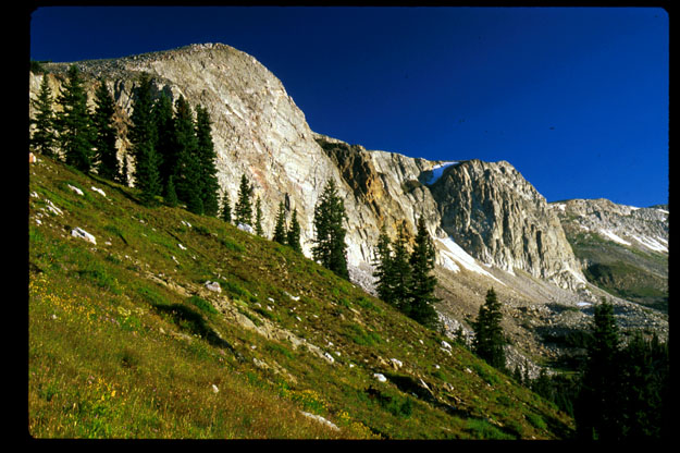
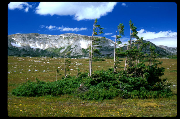
 Medicine Bow Mountains
- This is a view of the Medicine Bow range (also known as the Snowy's) in
Medicine Bow National Forest
in Wyoming. It was taken just a short distance up the trail to Medicine Bow
Peak. The trail leaves from the Snowy Range Scenic Byway. Medicine Bow Peak
itself may be visible far to the right in the image, but I am not sure.
-
 View from Medicine Bow Peak
- The is the view from the top of Medicine Bow Peak (12013ft=3662m).
The trail is quite easy in
comparison with most that I take. I was only in this range two nights and I got
hailed on both nights. That ever interesting mountain weather.
-
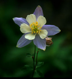
 Alpine Flower
- This is a columbine that was along Medicine Bow Lake
(the lake visible in the previous image).
-
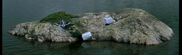
 A Difficult Life
- This is an "island" in Medicine Bow Lake with an interesting tree
growing on it.
-
 A Harsh Life
- The Snowy Range Scenic Byway reaches elevations of 10847ft (3306m)
so it is
well above treeline. This is what some of the trees near the road look like.
They have branches only opposite the normal wind direction and they are
growing as much horizontally as vertically.
Back to Drew's Home Page,
Photo Page
July 14, 1999 - (
milsom@physics.arizona.edu)
 Colorado National Monument
 Golden Light
 Wheeler Peak
 Great Basin Stream
 The Great Basin
 Lehman Caves
 Another Snake Range Stream
 The Deep Creeks
 Ruby Marsh National Wildlife Refuge
 Inside a Glacier Carved Valley
 Lamoille Canyon
 Alpine Nevada
 Medicine Bow Mountains
 View from Medicine Bow Peak
 Alpine Flower
 A Difficult Life
 A Harsh Life