-
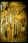
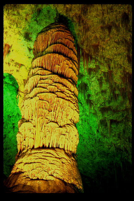
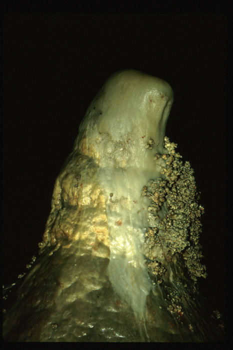
 Stalagmite/Stalactite Column
- This is a beautiful column in
Carlsbad Caverns National Park
in New Mexico. The odd colors are
created by the lighting in the cave.
-
 Cavern Floor
- This is a detail photo of a collection of features near the floor of
Carlsbad Caverns. It was taken with a flash.
-
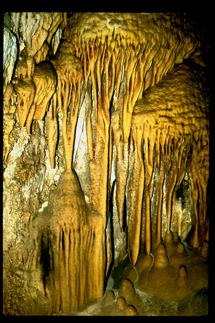
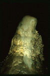 Stalagmite
- Here is a stalagmite with some interesting popcorn-like features at Carlsbad
Caverns. Again, it was taken with a flash.
-
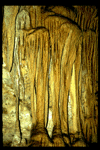 Cavern Wall
- This is a detail photo of some features on the wall of the cave. Again, it was
taken with a flash.
-
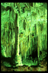 Deep Alcove
- This is the view into an "alcove" in Carlsbad Caverns. The color is due to the
lighting in the cave.
-
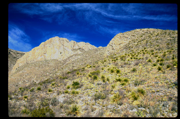
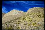 Desert View
- This is also at Carlsbad Caverns. A large part of the park is outdoors in the
desert. This is near the entrance of a desert canyon.
-
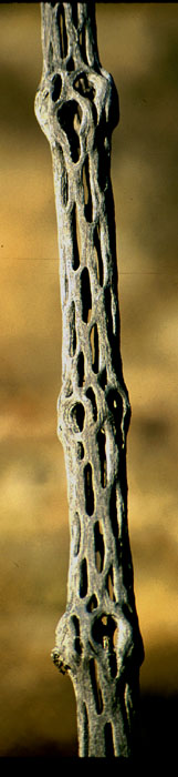
 Cholla
- This is taken in a juniper "forest" in Carlsbad Caverns after a nice hike up
???? canyon.
It is the stalk of an otherwise dead cholla. Normally, this isn't visible
since its surrounded by normal plant tissue and sharp annoying spines.
Note the "screaming face" near the top of the plant.
-
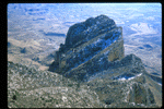
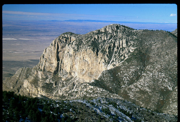
 Guadalupe Peak
- This is a photo of Guadalupe Peak (the bump on the right) at
Guadalupe Mountains National Park
in Texas. This park lies just south of
Carlsbad Caverns. Guadalupe Peak is the highest point in Texas at 8749 feet.
There is a pleasant (well probably not in July) eight mile round trip hike to
the peak. What looks like snow on the left side of the photo is in fact snow.
It doesn't snow that often there, but there was several feet of snow in some
places along the trail.
-
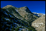
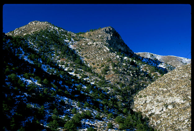
 Guadalupe Mountains
- This photo is taken from the top of Guadalupe Peak looking approximately
northwest. It is probably hard to see in the scanned image, but Sierra Blanca
(a peak in New Mexico about 120 miles away) is visible on the horizon in the
extreme upper right corner. It is the tiny whitish spot just below and to the
left of the cloud.
-
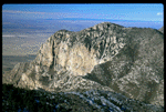
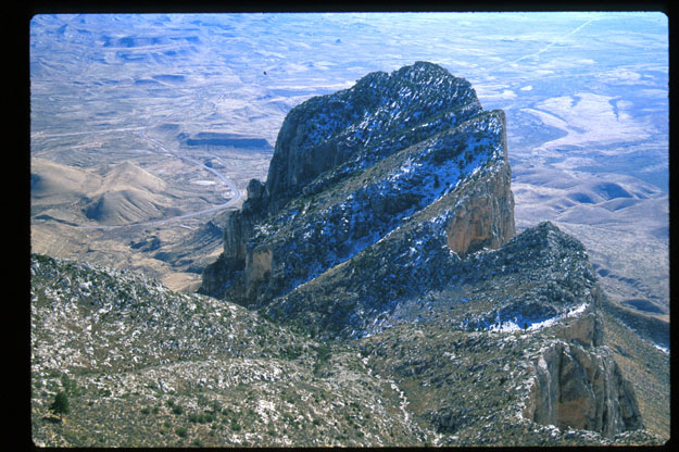
 El Capitan
- This is also taken from the top of Guadalupe Peak. It looks approximately
southeast on El Capitan which is the southern edge of the Guadalupe range.
The mountain (viewed from below) is a pretty famous landmark.
-
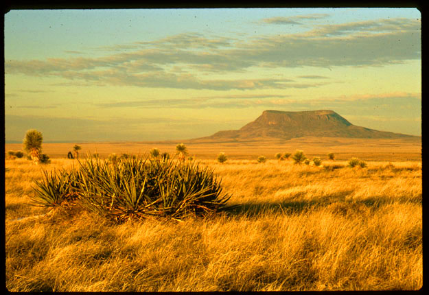
 Serene Landscape
- This photo was taken along R62 between Guadalupe Mountains National Park and
El Paso. The lovely mountain in the background is probably located on a
military base in southern New Mexico.
-
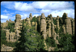 Chiricahuas
- This is a typical view of
Chiricahua National Monument
in southeast Arizona.
-
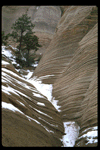
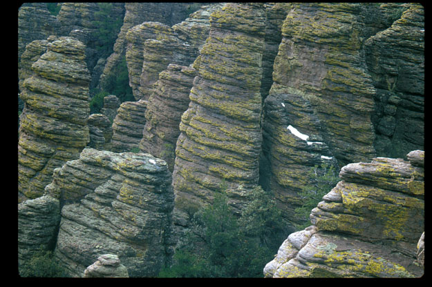
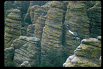 Geology at its finest
- Here is a detail photo of some of the columns at Chiricahua National Momument.
Unfortunately,
It was pretty overcast when I took this. Some snow is visible in the photo.
The sections of the park we visited were as high as perhaps 8600 feet. The
south-facing slopes were dry but the north-facing slopes had a fair amount of
snow. At still higher elevations, the snowcover was quite deep.
-
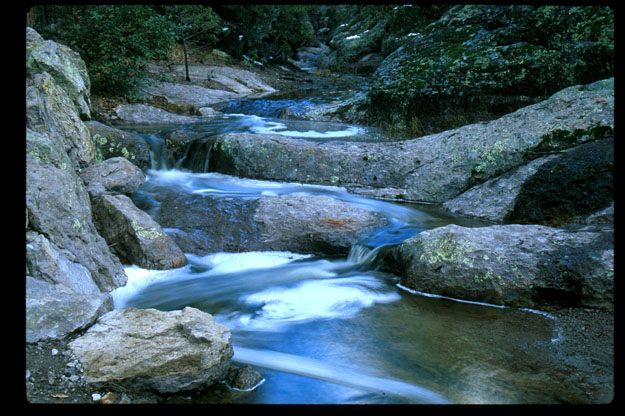
 Bubbling Brook
- This is a time-lapse photo of one of the lovely streams at Chiricahua National
Monument.
-
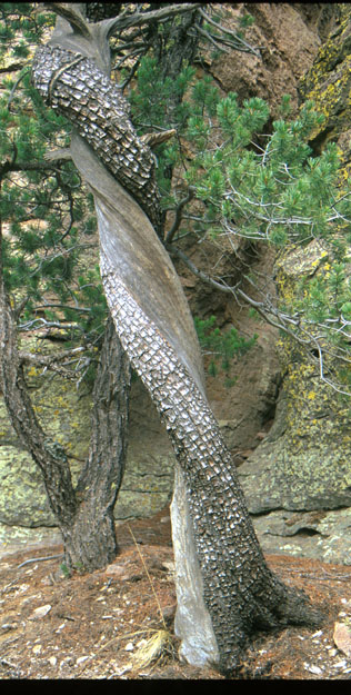
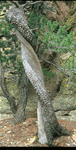 Silent Guardian
- Here is an extremely twisted alligator juniper growing in Chiricahua National
Monument.
-
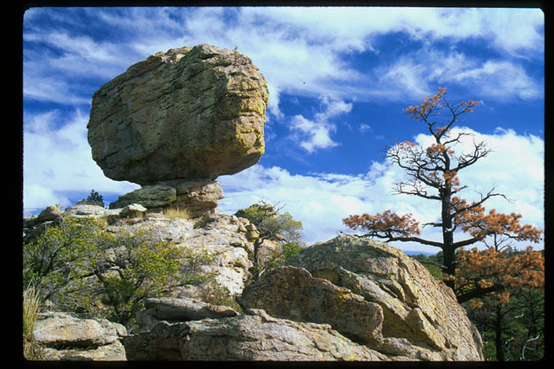
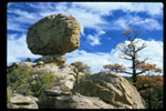 Balanced Rock
- Here is a balanced rock at Chiricahua National Monument.
-
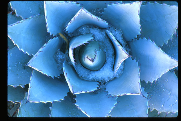
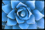 Blue Agave
- Here is a photo of an agave which I took in my friend Ralph Williams' garden. Note the snow/ice and the reflections of its spines.
-
 Tentrocks
- This photo was taken at a place on BLM land called Tent Rocks. Note the large
rocks on top of the spires. Unfortunately, many have been knocked off by idiots
with guns. Note that there is a tree growing from the top of the central spire.
n
-
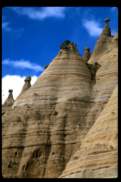
 Layers of Rock
- This was also taken at Tent Rocks. It shows some of the nice strata visible
in the rock.
Back to Drew's Home Page,
Photo Page
July 14, 1999 - (
milsom@physics.arizona.edu)
 Stalagmite/Stalactite Column
 Cavern Floor
 Stalagmite
 Cavern Wall
 Deep Alcove
 Desert View
 Cholla
 Guadalupe Peak
 Guadalupe Mountains
 El Capitan
 Serene Landscape
 Chiricahuas
 Geology at its finest
 Bubbling Brook
 Silent Guardian
 Balanced Rock
 Blue Agave
 Tentrocks
 Layers of Rock