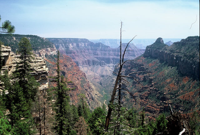
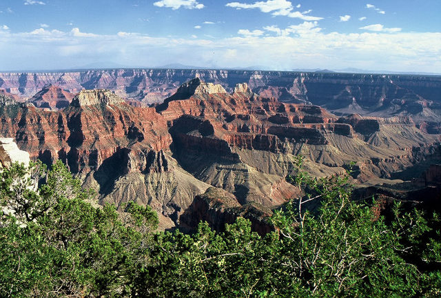
I spent several days at the North Rim of Grand Canyon National Park. This image was taken from along the Widforss Trail and looks into the area known as the Transept. There were a number of fires burning on both the north and south rims which contributed to the hazy atmosphere.
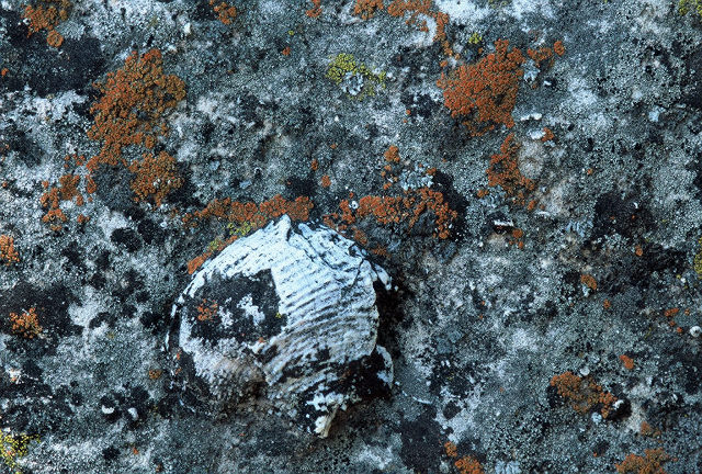
This was also taken from along the Widforss Trail. It was part of a small rock outcrop along the trail. The rock at the top of the canyon is part of the Kaibab limestone so fossils (like this one) were pretty common. If you are interested here is some information about the geology.
This was taken from the Ken Patrick Trail.
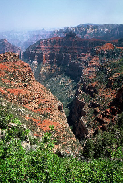
This was also taken from the Ken Patrick Trail.
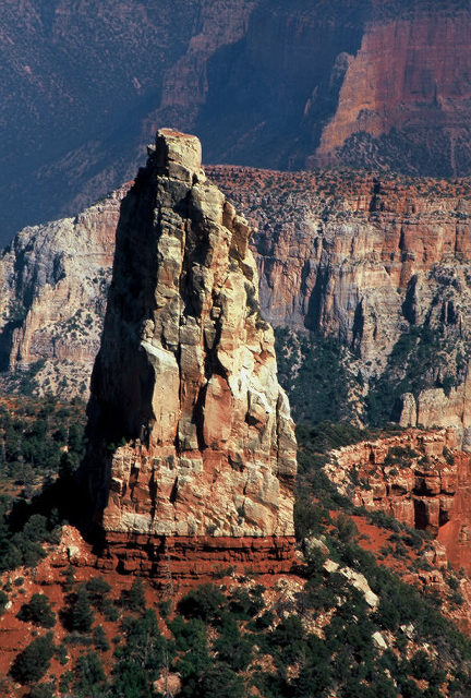
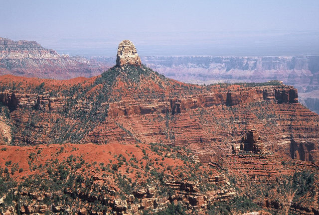
This is taken from the parking lot at Point Imperial which is the highest point (8803 feet = 2683m above sea level) along the north rim. The impressive peak is Mount Hayden.
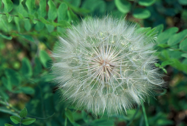
This is an image of a salsify (genus tragopogon) which has gone to seed. It was taken along the Uncle Jim Trail.
This lovely view is taken from the Grand Canyon Lodge at the North Rim. Wouldn't you like to wake up to that view?
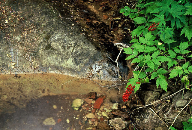
The Saddle Mountain Wilderness borders Grand Canyon National Park on its northeast corner. I hiked from the Kaibab Plateau down the North Canyon Trail into the wilderness. As the link here says, North Canyon has running water and this is an image of that stream. If you happen to know what the berries are, let me know. I only hiked about four miles round trip but it was a steep trail and the views as you descend are fantastic. Note that I also saw some mountain lion tracks on this trail. The cat clearly followed the trail for a few hundred meters before veering off into the forest.

This is an interesting geode in a rock located maybe a quarter mile from where I took the previous photo.
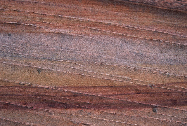
This photo was taken in the Coyote Buttes section of Vermillion Cliffs National Monument. This fantastic area of eroded sandstone has become quite popular since the mid 90s. The Bureau of Land Management limits access and you can click here to get permit information. The sandstone color varies drammatically as this image illustrates. The section of sandstone is about one foot across.
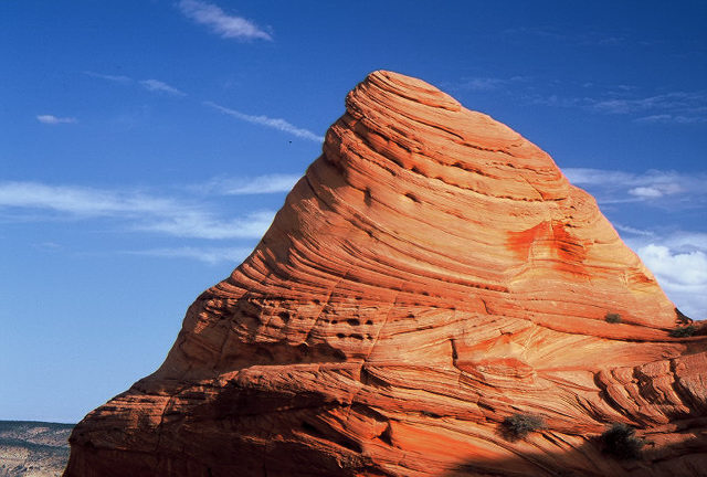
This is the only image I have with any real blue sky. It was a very cloudy day and I got rained on a bit as well.
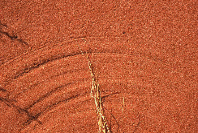
This small and most likely dead plant was blowing back and forth in the wind and created these circular arcs.
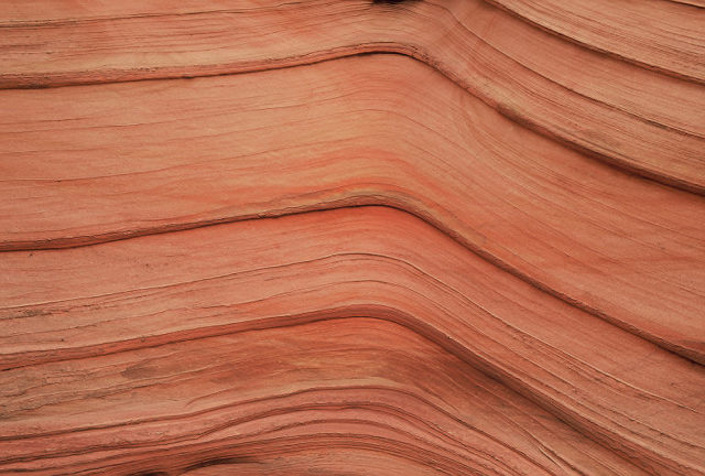
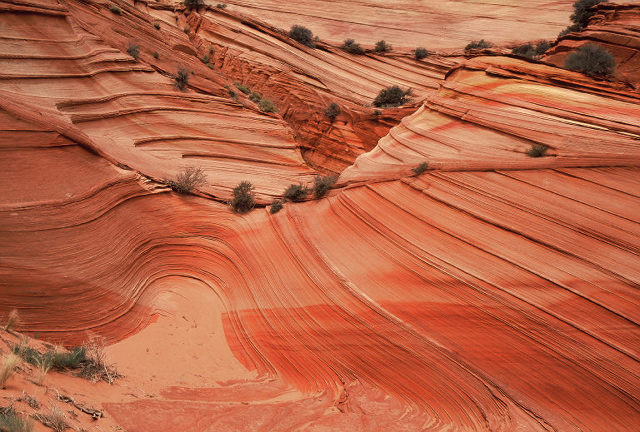
The ridges were quite impressive in places. The section of sandstone is about five feet across.
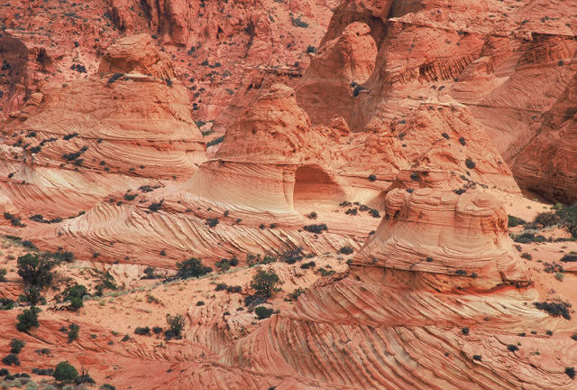
I was in what is offically referred to as South Coyote Buttes and these are some of the more impressive formations. Note that it was actually raining when I took this image!
And here was one of the more impressive features which I found as I was nearing my car.
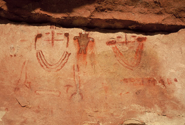
This image and the next are pictographs from "some" location in Northern Arizona/Southern Utah. I would prefer to keep the exact location a secret.
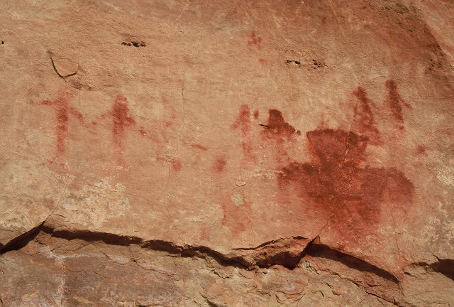
More of these pictographs will follow in the next link.
Back to Drew's Home Page, Photo Page
December 21, 2009 - ( milsom@physics.arizona.edu)